Showing posts with label Then and Now. Show all posts

Thursday, January 28, 2016

Then and Now: The Hat

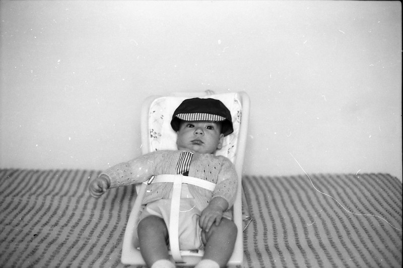
Here's a picture that Dad took of me when I was around a year old. Not the best photo in a technical sense, but still interesting. Especially the hat. It looks like it doesn't fit me, like it's two sizes too big. The interesting thing is.... IMG_0024


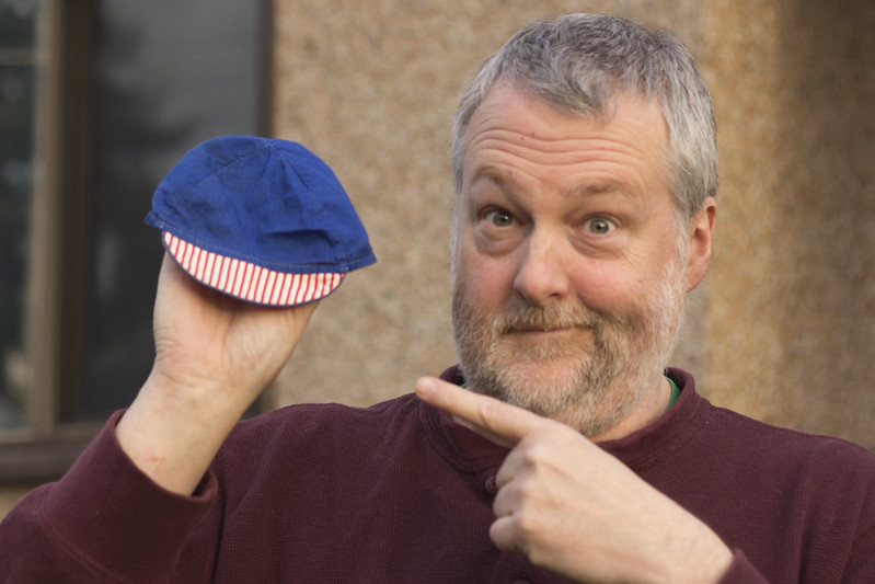
...the hat still doesn't fit me. _MG_7592 copy
Thursday, October 16, 2014

Then and Now: Rockies Road

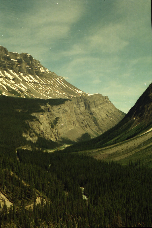
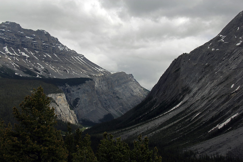
In the summer of 1976, my dad rented a VW camper van and the two of us drove around southern BC and the Rockies. There's a chance that I might have taken this one; I held his camera while he was driving and was taking shots out the window. But we did stop to take shots, so it's hard to know which of us took which shots as that knowledge has passed into the misty murkiness of failing memories. Regardless, it was taken somewhere on the road between Jasper and Banff, somewhere near the Columbia Icefield. What I love about this picture is the curving of the layers of rock. Can you imagine the force needed to bend those layers over time? Wow.
IMG_0076
Clearly, this mountain made an impression on me, as in 2013 I took a new picture of the same mountain. IMG_0176
Thursday, October 2, 2014

Thursday, September 4, 2014

Then and Now: Victoria Harbour 1971

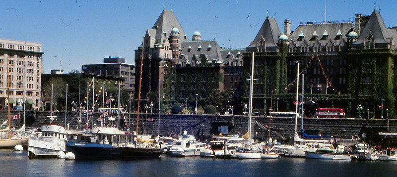
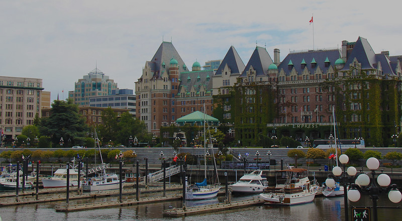
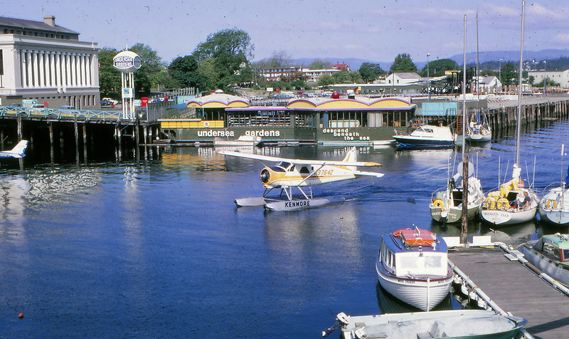
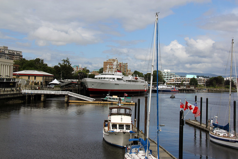
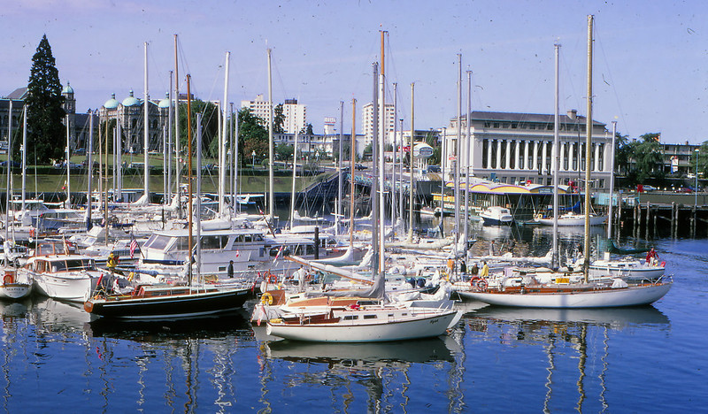
This is a shot my dad took of Victoria's Inner Harbour in 1971, and below it is a shot of the harbour I took a few weeks ago. My, how things have changed. 1971 Inner Harbour Victoria

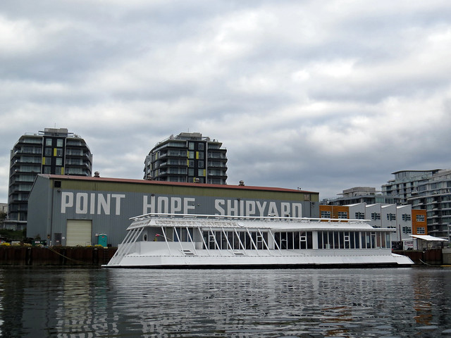
In the foreground, the most obvious change is the rearrangement of the docks. Seaplanes still come into the harbour, but they don't dock in this part of it anymore. In the background, well, nothing's the same. All the buildings are gone, and the big piers jutting out into the harbour are gone. The MV Coho that dominates my photo docked on the other side of the harbour in 1971. The only building that remains is the old CPR Steamship Terminal building in the top left corner. In 1971, it was the Victoria Royal London Wax Museum; after recent renovations and seismic upgrading it's now the Robert Bateman Centre. IMG_5939 Missing entirely now is the Undersea Garden (seen behind the seaplane in dad's photo). The Undersea Gardens was a long-time tourist attraction in the harbour. It's a 150-foot purpose built vessel where, according to Wikipedia, visitors "....descended 15 feet (4.6 m) beneath the ocean surface to look through the many viewing windows of the aquariums that surrounded the vessel and see the various marine life of coastal British Columbia, in their natural and protected environment." It was originally opened at the Oak Bay Marina in 1964, then it was towed to the Inner Harbour in 1969, but closed last year. We saw it this past January while kayaking in the harbour. It was towed to a shipyard where it sat waiting to be scrapped or sold. IMG_2064
Thursday, July 17, 2014

Then and Now: Across the Harbour

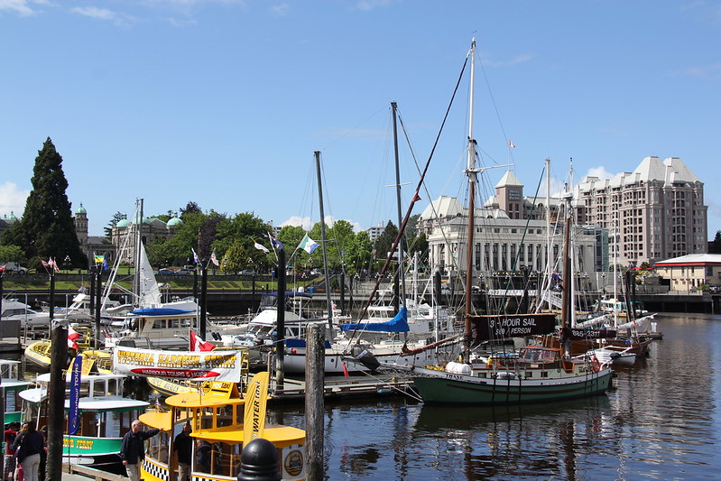
A 1971 shot looking across Victoria's Inner Harbour taken by my dad. 1971 Victoria Harbour
As we can see from a recent photo that I took below, from this angle the harbour looks like it hasn't changed much with the exception of the addition of the looming Grand Pacific Hotel. But looks can be deceiving; this is probably the one view, towards the Legislature whose blue domes you can see in the trees, that hasn't changed radically through the years.IMG_5960
Thursday, May 8, 2014

Then and Now: St. Joseph's Oratory

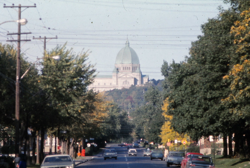
Here's a picture my dad took of St.Joseph's Oratory of Mount Royal in Montréal. It began life as a small chapel in 1904, but has grown and been rebuilt throughout the 20th century. The current configuration was completed in 1967. According to Dad's records, this shot would have been taken on Avenue de Somerled looking North-ish towards St. Joseph's in 1970. 1970 St Josephs from Somerled
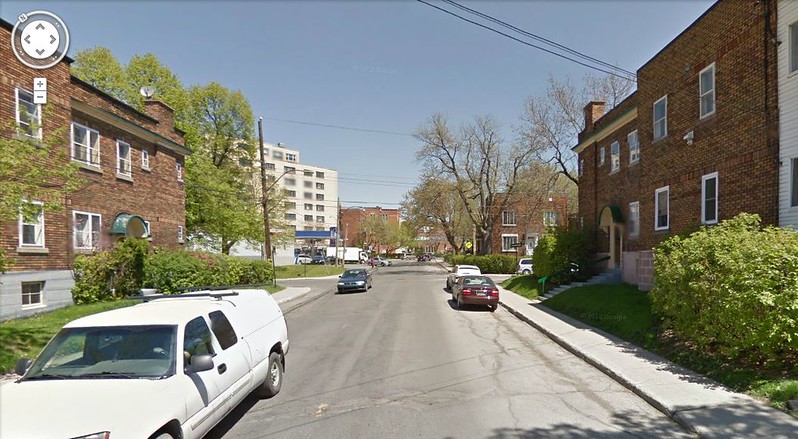
Or was it? Below is the modern Google Maps view. This is Somerled looking North-ish, just south of Oxford. I'm fairly certain I'm in the correct spot. The cross street ahead is a one-street crossing left-to-right in both pictures, there's a brick house on the right corner that look similar (red brick with white windows, grey at ground level, with a small window in the grey area), and the street ends in just a couple of blocks. The only thing missing in the Google Maps view is, of course, St. Joseph's.
So either Dad got his street wrong, or a super-villain has kidnapped the largest Church in Canada. But Somerled is the only street that points directly at the side of St. Joseph's like that. And it's hard to imagine that the entire hill has disappeared. What is going on here?
There may be another explanation other than the nefarious machinations of Lex Luthor. First, the height of the Google Street View car picture is higher than the height of my Dad, so that may have affected the angle of view of the Google pic. I also wonder if Dad was using a telephoto lens which may have resulted in some foreshortening of the image, making St.Joseph's appear closer than it is. If I've got the right spot, St. Joseph's is still about 2 km away. And the Google folks would have been using a wide angle lens, making St.Joseph's appear even further away. An interesting illustration of how an image can be manipulated by the lens you choose.
On the other hand, that's a lot of missing hill and church to account for. I may just have to go back there one day to solve the mystery!
Capture


Addendum:
Reader Stephanie found this Google Map image from a little further up the street where you can see St. Joseph's poking up. The angle is nothing like my father got, but at least one can see the Oratory.


Then reader Blair found this image with a better view of the oratory which when cropped gives a view of the oratory remarkably similar to what dad shot. It is an interesting study of perspective and lenses. All the photos were taken within a couple of blocks of each other, and yet each have different views of the church.

Sunday, December 8, 2013

Then and Now: Fountain

Here's a couple of pictures my father took of the lighted fountain at Centennial Square in Victoria in 1974. I assume they were taken at the same time as the set-ups look identical.

IMG_0039 IMG_0038

Here's a picture I took of the fountain tonight during the Great Freeze of 2013. IMG_3328

Wednesday, May 8, 2013

Then and Now: Centennial Ledge

Anyone want to guess when this picture was taken? Why, yes. 1971. How could you tell? 1971 was the 100th anniversary of British Columbia's entry into Confederation and Victoria was all decked out in Anniversary decorations. Dad took this pic of the Ledge in the fall of 1971. 1971 The Ledg Compared to the picture below that I took of the Ledge last summer, not much has changed. The trees are bigger, of course. But the other change I see is that vehicle traffic is no longer allowed along the walkway right in front of the main stairs. P7234532

Thursday, April 11, 2013

Then and Now: Happy Birthday to Me!

Happy birthday to me! I wonder what it was I just go away with. IMG_0011
I still do that face!